When I got up in the morning, I looked out the window and it was snowing lightly. There was an accumulation of less than an inch but everything
was white. At breakfast we discussed the road situation and decided to wait until 9 to leave to let the sunlight improve the road
conditions. When we left the road was still quite slushy all the way until we made the turn south on Highway 385.
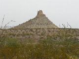
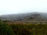
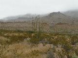
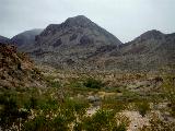
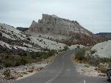
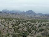
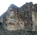
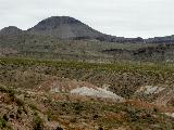
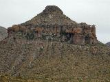
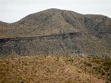
It probably wasn't the best day for the scenic drive as there was a cold mist until early afternoon and the temperature was around 35F.
Some of the mountain views were mist covered which in some cases added to the beauty. It was very windy all day.
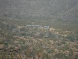
Next we stopped at the Rancher's Oasis, a site where Sam and Nena Nail farmed. They had installed a well that provided water for their
livestock and crops. The well is still pumping water to feed the trees in that location. I'm not sure my photo shows the water running out
too well, but it was a steady stream about as half as intense as an open water hose might be.
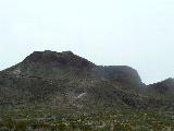
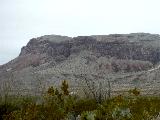
So we continued on the highway with frequent stops to view the mountains, etc. The mists obstructed some of the views, but I was able
to cull a few rather good ones from the many I took.
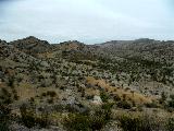
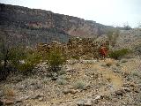
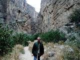
When we stopped at the Wilson Ranch overlook we debated doing the walk to the cabin for a while. It looked pretty far in the fog, but
we asked a couple returning from the walk and they assured us it wasn't too bad. As we headed out the sign said and it was a steep slope, but
that it was only .5 miles to the cabin. The steep slope may have been a blessing because it seemed to shield us from the wind.
From there we continued toward the south end of the park, stopping at numerous pullovers along the way until we reached the
visitor center at Castolon.
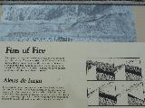
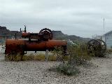
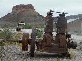
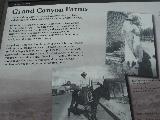
The visitor center at Castolon was closed. There was a recent fire there that destroyed some of the buildings. Restrooms were available, but
what interested me was the old equipment that was there. Apparently at one time this particular spot contained a cotton plantation. The water
from the Rio Grande made this area rather fertile and the moisture for the crop was handy.
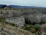
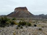
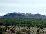
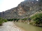
From there we headed towards St. Elena trail but made a few short stops on route. The first was an overlook near Cottonwood. Not sure what
it was called but the view was back north. The near mountains were clear but the further mountains were still foggy.
A little further down the road was another pull off for a farmland trail. I took some views of the river across the road. We debated doing the
farmland trail that would bring you to other ruins from the farm, but decided to skip that and go to St. Elena.
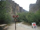
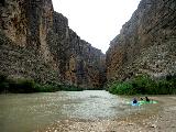
So we got to the Santa Elena River access parking area. This is a popular area in the park. It was the first place we encountered numerous
other tourists. We made our way to the river and took a few pictures of the scenery before looking for the continuation of the trail.
It wasn't very well marked from the river to continue the trail, but we followed the others.
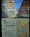
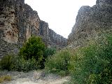
Immediately after crossing an inlet to the river bed we had to climb a very steep accent; needed three point stance to make it up
there. Then we had to descend a bunch of dirty rocks down the other side. Next, we climbed up lots of steps up, then back down to follow river.
The views were very nice all through. The trail sign makes it look straight forward but it was not.
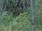
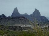
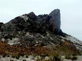
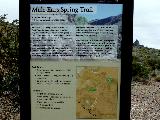
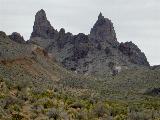
So on our drive from Wilson Ranch we passed by the Mules Ear Spring Trail Viewpoint. We stopped there on our way home and did a short walk to see what
was there to see.
As we headed back home the northern part of the park was clearer but still had some thick clouds hiding parts of the mountains.
We didn't stop for any more photos because it was already getting late. As we left the park heading back to Alpine we watched the
outside temperature dropping a degree every few miles. AS we entered Alpine it was down to 25 degrees and snowing. That didn't stop us from
stopping at DQ for another chili cheese dog.